Place name dictionaries and catalogues
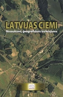
"Latvijas ciemi. Nosaukumi, ģeogrāfiskais izvietojums" - Rīga, LĢIA, 2007.
Dictionary of Latvian village names, which includes 8879 names of 1479 settlements in Latvia. They are arranged after 15.10.2006. administrative division and supplemented by brief comments of a philological and geographical nature. An alphabetical list of names has been added, as well as information on the approximate population of the villages. According to the data of the State Address Register (2006), the official names of the settlements that have been officially granted the status of a village are indicated.
The book shall, as far as possible, include all rural settlements, consisting of at least three houses with a unifying name and recognized as villages by local authorities and / or residents.
The publication is based on the data of village names from the Satellite Map of the Republic of Latvia M 1:50 000. The database of Place Names and many written and cartographic sources of geographical names are also used in the work. The information was obtained and clarified by interviewing specialists of the regional divisions of the State Land Service, employees of local governments, local residents.
The research is of a recommendatory, informative and cultural-historical nature. The publication is intended as a source of information for a wide range of users and a guide for those who work with Latvian place names. The book will be useful when assigning, clarifying or changing the official names of villages, parishes, counties. Can also be used in regional planning, cartography, communication.
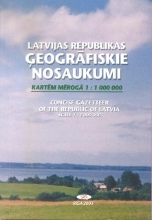
Latvijas Republikas ģeogrāfiskie nosaukumi kartēm mērogā 1:1 000 000. Concise Gazetteer of the Republic of Latvia Scale 1:1 000 000. — Rīga: VZD, 2004; elektroniskais izdevums atjaunots 2008 – 2009.
The gazetteer includes the names of the most important geographical objects of Latvia - all cities, the most important villages, the main features of the Baltic Sea and its coast, the largest lakes, the longest rivers, highlands and their highest hills - the geographical coordinates and location according to administrative territorial division.
Place names are agreed with the relevant official sources and the State Language Center of the Ministry of Justice of the Republic of Latvia.
The names of the settlements are provided in accordance with the data of the Address Register, supplemented with information from the Place Names Database. The number of inhabitants in cities is indicated according to the data of the Central Statistical Bureau, the number of inhabitants in villages - according to the encyclopedia “Latvian Parishes”.
Annex 1 of the gazetteer contains a list of administrative territories and territorial units of the Republic of Latvia (according to the classifier ATVK, December 1, 2008).
Cartographic appendices (scheme of administrative districts and cities of the Republic, general geographical map of Latvia and map of administrative territories and territorial units) have been prepared by the Cartography Board.
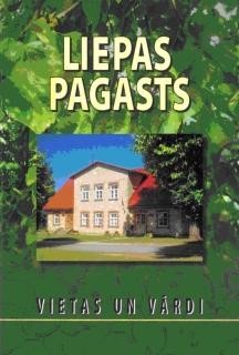
Liepas pagasts - Rīga: LĢIA un Liepas pagasta padome , 2009.
Latvian Geospatial Information Agencies have published a book - a local history and toponymic study of Liepāja Parish, Cēsis District. It was created in cooperation with the Toponymy Laboratory of the Cartography Department of the Latvian Geospatial Information Agency and Liepa Parish Council.
The book describes natural and cultural-historical objects, settlements, summarizes all known names. In order to preserve the richness of the place names of the parish, the book also includes the names of objects that have already disappeared (former homesteads, pubs, etc.). An insight into the history, culture and economy of the parish is provided. The book is richly illustrated with color and black and white images (modern and historical photographs, drawings, map fragments, etc.). It contains photos of almost all farmsteads and other residential houses in Liepa Parish.
The volume of the book is 308 pages. Attached is a colored map of Liepa parish in scale 1:25 000 and a plan of Liepa village in scale 1:10 000.
The work can be useful for the people of Liepaja and surrounding parishes, local researchers, pupils, students and anyone who is interested in the nature, people, history and place names of Liepa parish.
Authors of book texts: Valda Ermane, Sarmīte Pliuna, Benita Sausiņa, Otīlija Kovaļevska
Book organizer and editor Otilija Kovalevska
Literary editor and proofreader Baiba Ivulāne
Cartographer Baiba Gitendorf
Layout designer Marika Marcinkus
Artistic design of Marika Marcinkus
Benita Sausiņa, Aivars Vilnis, Aija Struņķe, Raimonds Renčs, Valdas Ermane, Vita Strautniece, Juta Audzere, Romualda Beļavskis, Indulis Krauze, Valdis Brauns, Ivars Valdmaņa and others are used in the book. c. photos. Images from the archive of the Liepa library, the archive of the Social Service and the Liepaja branch of the LKLS association, personal archives of the people of the parish, as well as an orthophoto map prepared by the State Land Service in 2005 were used.
Printed in the printing house "Latvijas karte" of the Latvian Geospatial Information Agency.
ISBN 9984-28-235-X
© Latvijas Ģeotelpiskās informācijas aģentūra, 2009
© Liepas pagasta padome, 2009
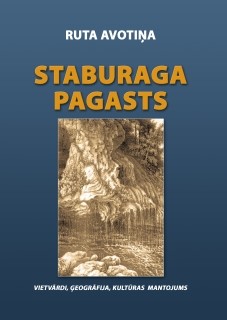
Ruta Avotiņa STABURAGA PAGASTS. VIETVĀRDI. ĢEOGRĀFIJA. KULTŪRAS MANTOJUMS.
Staburags parish has existed only since 1945 and is territorially the old part of Sēlpils parish, therefore this work can be considered as a study published in 2003 “Sēlpils parish. Nature. Inhabitants. Inhabited places. History ”(re-published in 2005).
The book is richly illustrated with modern and historical photographs. The materials of the Aizkraukle Museum of History and Art, the State Historical Archive of Latvia, the Archive Documentation Center of the State Inspection for the Protection of Cultural Monuments, the Latvian Place Names Database of the LGIA Toponymy Laboratory, unpublished materials of Staburaga Parish Council and Vīgante Primary School, and the diary of composer Pēteris Barisons have been used.
The book will be useful for cartographers, press officers, land developers, as well as local researchers, tourists and anyone interested in the nature, history, culture and place names of the region.
Attached is the map of Staburaga parish in scale 1:25 000 and 2 map schemes.
The book has been prepared and published with the support of Staburags Parish Council.
ISBN 9984-28-416-6 © Latvian Geospatial Information Agency, 2007.
Ruta Avotiņa. Sēlpils pagasts. Novadpētnieciska vietvārdu vārdnīca. Daba. iedzīvotāji, apdzīvotās vietas. - Rīga, VZD, 2005. - Rīga, VZD, 2003; supplemented and clarified edition 2005.
Local history and toponymic research on Sēkpils parish of Jēkabpils district, which describes geographical (natural objects, settlements, etc.) and cultural-historical (castle mounds, settlements, ancient cemeteries, cemeteries) objects. For each reality, all known names are listed, from which one basic name is chosen, which is recommended for further use. In order to preserve the set of place names of the parish, information on former but no longer existing geographical and cultural-historical objects and their names is also provided. The dictionary contains a description of the natural conditions of Sēlpils parish, information about the inhabitants and settlements, as well as a historical description of the parish.
The appendix to the second edition of the dictionary contains the chronicle of Sēlpils parish, map in sclae 1:25 000 and 10 map schemes.
The work could be useful not only for every inhabitant of Sēlpils parish, but also for press staff, cartographers, land developers, local researchers, tourists - all whose interests are related to the nature, people and history of Sēlpils.
The book has been prepared and published with the support of Sēlpils Parish Council and Daugava Foundation.
Zaubes pagasts. Vietas un vārdi. - Rīga, VZD un Zaubes pagasta padome, 2005.
Local history and toponymic research on Zaube parish of Cēsis district. It describes natural and cultural-historical objects, settlements (villages and farmsteads), summarizes all known names. Data from the Latvian Place Names Database, literature and map sources, materials from field surveys, school archives, Zaube Parish Council and local local researchers, records of local residents' memories were used. In order to preserve the richness of parish place names, the book also includes the names of already extinct objects (former farmsteads, pubs, mill lakes, etc.). An insight into the history of the parish and the life of the people at different times is provided.
The book is richly illustrated with historical and contemporary photographs. It contains photos of almost all farmsteads and other residential houses in Zaube Parish. The appendix contains two map schemes, as well as the map of Zaube parish in scale 1:25 000.
The publication will be useful for the people of Zaube and the surrounding parishes, as well as for local researchers, pupils, students and anyone who is interested in the nature, people, history and place names of Zaube Parish.
The book has been prepared in cooperation with Zaube Parish Council.
Latvijas vietvārdu katalogs Kopējo operāciju kartes (JOG) 1. izdevumam mērogā 1:250 000. Gazetteer of Latvia for the Joint Operation Graphic (JOG) 1st Edition at Scale 1:250 000. - Rīga: LĢIA, 2007. (for military purposes)
The catalog is created in accordance with NATO standard (STANAG) No. 2213 "Catalogs of geographical names" (4th edition).
The catalog covers the entire territory of the Republic of Latvia, as well as parts of the territories of neighboring countries (Estonia, Russia, Belarus, Lithuania) depicted on the JOG map pages under Latvia's responsibility.
The introduction provides a description of the area shown on the map, a list of sources used to compile the catalog, a description of the official languages, the transliteration systems used in the catalog, a glossary of geographical terms (nomenclature words), a list of level 1 units, etc. c. information.
The list of geographical names includes all the geographical names shown in the 1st edition of the JOG map (indicating errors and adding the most important variants of names), indicating the type and location of the corresponding geographical object.
Latvijas vietvārdu katalogs kartēm mērogā 1:1 000 000. Gazetteer of Latvia for Maps at Scale 1:1 000 000. - Rīga, VZD, 2005. (for military purposes)
The catalog has been prepared in the Toponymy Laboratory of the Cartography Board of the State Land Service of the Republic of Latvia, using the Latvian Place Names Database and maps compiled by the Cartography Board as the main sources. The information contained therein is consistent with the relevant official sources.
The catalog has, as far as possible, been developed in accordance with NATO Standard (STANAG) No. 2213 "Catalogs of geographical names" (4th edition).
The catalog includes only the territory of the Republic of Latvia.
It includes the names of the most important geographical objects of Latvia - the names of all cities, the largest or otherwise significant villages, the main objects of the Baltic Sea and its coast, the largest lakes and bogs, the longest rivers, highlands and their highest mountains. The catalog of geographical names consists of introductory texts, a schematic overview map, a list of geographical names and two cartographic annexes in the scale of 1: 1 000 000. The publication includes a list of the highest level units of the administrative division of the Republic of Latvia as of 01.12.2005.