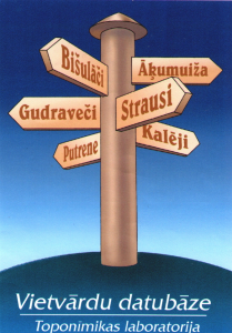
Place name data in Open Data
The Place Names Database maintains information on place names (geographical names or toponyms) and their corresponding geographical features - both natural and man-made. We offer users a data set from the Place Names Database with names that refer to 110.6 thousand geographical features (data as of February 1, 2022). The information covers the entire territory of Latvia. Names in languages of the neighboring countries are also shown for features crossing the national border (transboundary features).
The basic or the preferred name is the name of the specific feature which of all those stored in the database is recognized as the most suitable for use or official approval (including the correction of an unsuccessfully approved name) in accordance with requirements of the Cabinet of Ministers' Regulation of 10.01.2012. No. 50 "Regulations Regarding Geographical Names Information".
It is important to know that the "Other names" column includes other names and name variants of the particular feature in the database, without specifying which ones are erroneous or outdated, or refer only to a section of the watercourse.
The coordinates indicate the locations of point features, the approximate centers of areal features and the mouths of watercourses.
Approximate routes of watercourses (linear objects) with basic names and secondary names are included in the .shp format file. The second name is either the parallel basic name, which refers to the entire watercourse, or the name of a part of it. For transboundary watercourses the name of a neighboring country is indicated. The names of the rivers (or sections of them) lying in territories of Lithuania and Estonia are given in their original transcription, in Russia and Belarus - transliterated in the Latin alphabet (in accordance with the national transliteration tables of these languages recognized by United Nations). A list in .csv format is added to inform users about which watercourses are included in the .shp file.
Coordinate system: Geographical – WGS-84 (EPSG:4326).
Record of coordinates: DD
Text encoding: Windows1257
The data set does not include all public information available in the Place Names database, but a selection of it. We invite you to use the public version of the Place Names Database as well: https://vietvardi.lgia.gov.lv/
The available information on the place name and its corresponding geographic feature can be useful for:
- proper use of place names;
- finding different geographical objects;
- approval of official place names;
- teaching and scientific work;
- preparation and verification of maps and plans;
- preparation of various data sets and reference materials, etc.
For details: vdbinfo@lgia.gov.lv
Contact person:
-
Vita Strautniece
vita.strautniece@lgia.gov.lv
Place name data in .csv format
Place names of watercourses in .shp format