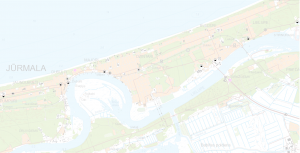
National geodetic network database data

The purpose of the National Geodetic Network Database (VĢTDB) is to collect, accumulate and maintain up-to-date information about the National Geodetic Network. The database makes up-to-date geodetic information available to those who need it. Both textual and graphical information about the points of the National Geodetic Network is stored in VĢTDB. In the VĢTDB data publishing application, it is possible to select data according to the selection criteria entered by the user. As a result of data selection, a list of geodetic points meeting the search criteria is created with minimal information about the points. The following actions are possible with the points in the selection result list:
-
export of textual data to MS Excel, both for all and user-selected points;
-
viewing the information stored in the database for points selected by the user;
-
preparation of a geodetic point map in .pdf format and its further processing (printing, saving) for one or several points selected by the user;
-
view a user-selected geodetic point on the map.
Geospatial data:
-
Regularity of data renewal
-
The data is updated once a month
-
Available languages
Latvian
-
Contact person:
-
Toms Tensons
toms.tensons@lgia.gov.lv
Data relevance as of 28.01.2026.