Overview map of the Republic of Latvia in scale 1: 250 000
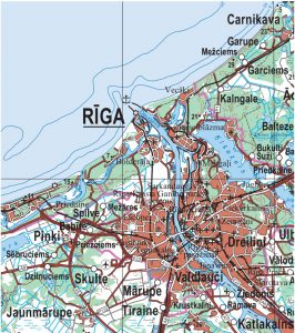
The map shows information about all settlements, road network, vegetation (forests, swamps), river network, water bodies (large ponds, lakes), highlands and terrain. In the frame part of the map there is a wide range of information about the length of the state border, the number of inhabitants in cities and villages, the highest mountains and the deepest lakes.
Data of the territory of Latvia are available in the LKS-92 TM coordinate system in ESRI coverage, geodatabase and SHP formats.
Contact person:
Toms Tensons
toms.tensons@lgia.gov.lv
DATA:
GEOJSON (97,33MB)
TIFF (283MB)
ArcGIS File Database (121MB)
METADATA