Orthophoto Maps of Latvian Cities 1997-2002.
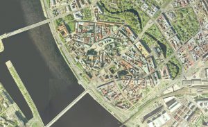
Orthophoto Archive - Latvian Orthophotos 1997-2002 year. The archive of cities orthophoto maps contains black-and-white and colored orthophoto maps of cities and densely populated areas with aero photography from 1994 to 2002 year. The scale corresponds to a 1: 1000 - 1: 2000 resolution of 10cm - 20cm. Published as ArcGIS WMS Services. WMS v.1.3.0.
The service contains data for the following aerial photography year and 33 cities:
| Ainaži 2002. | Jēkabpils 2002. | Saulkrasti 2002. |
| Alūksne 2002. | Jūrmala 2002. | Sigulda 2002. |
| Ancene 2002. | Ķekava 1999. | Stopiņi 1999. |
| Balvi 2002. | Lapmežciems 2002. | Subate 2002. |
| Bauska 2001. | Liepāja 1997. | Talsi 2002. |
| Carnikava 2001. | Limbaži 2002. | Talsi-Roja 2002. |
| Cēsis 1998. | Madona 1998. | Valka 2002. |
| Dagda 2002. | Mērsrags-Roja 2002. | Ventspils 2001. |
| Daugavpils 1997. | Ogre 2001. | Voldemārpils 2002. |
| Engure_Mērsrags 2002. | RĪGA 1999. | Zvejniekciems 2002. |
| Jelgava 2001. | Salaspils 1999. |