Black and white orthophoto map 1994-1999. (Cycle 1)
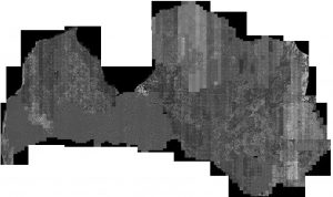
Made in 1994-1999 in cooperation with the Swedish company Swedesurvey Oy. 1994-1995 Orthophotos were made in Sweden by Swedesurvey Oy for the aerial photography areas of. In 1995, aerial photography of Daugavpils city and district was performed in cooperation with the Danish Ministry of Agriculture, aerial photography works are performed by the company "Kampsax-Geoplan", and orthophoto maps are produced by the State Land Service (SLS). 1997-1999 The processing of aerial photography scenes and the production of orthophotos was performed in Latvia, SLS. Aerial photography was performed with analog cameras to obtain black and white aerial M1: 30,000. Prepared black and white orthophoto maps with a resolution of 1 meter. One digital standard orthophoto map page has a file capacity of 25 MB. For the eastern border of Latvia were purchased in 2000-2001. of ICONOSS satellite images.